Languages:
Khoy
Khoy (Persian: خوی, Armenian: Հեր, romanized: Her or Խոյ, Azerbaijani: Xoy/خوی, also spelt Khoi or Khvoy, is a city in West Azarbaijan Province, Iran. It is located north of Urmia. The region's economy is based around agriculture, particularly the production of fruit, grain and timber. As of 2012, the city had a population of approximately 200,985. Today the city's population is mostly Azeri, there are also Kurdish, Assyrian and Armenian minorities. The main religion is Shia Islam there is also a Christian minorities. Occupied since Median times, it shares a long history as an important Christian centre.
Spoken languages.
Today Azerbaijani is spoken in Khoy, while nearly all inhabitants can also converse in Persian.
There is a specific Khoy dialect (Armenian: Խոյի բարբառ) in Armenian language common for Urmia, Salmast, Khoy, Maku regions of modern Iran, Nakhichevan, Shahbuz, Kangarli, Sharur, Sadarak districts of modern Azerbaijan and Aralik district of Igdir province of modern Turkey.
Name origin.
Historical i.e. Armenian name of the city is Her Armenian: Հեր (in Armenian for Father) also was the name Khoy (Armenian: Խոյ) in use which in Armenian means Aries that concludes the heavy presence of the species in surrounding areas in past.
Azerbaijani explanation for the name originates from the shape of the city, because it is in the shape of a hole and it is next to "Avrin" mountain.
Hıstory.
Khoy was named in ancient times for the salt mines that made it an important spur of the Silk Route. 3000 years ago, a city had existed on the area where Khoy is located nowadays, but it's name became Khoy only from 14th centuries ago. In 714 BC, Sargon II passed the region of which Khoy is part of in a campaign against Aratta (Urartu).
Since the 331 BC this city was a part Her district (gavar) of Nor-Shirakan province (ashkar) of the kingdom of Greater Armenia. Khoy was mentioned in VIII century AD and was called Her by Anania Shirakatsi in "Ashkharatsuyts". Since then up to 1920 Turkish intervention the sity has a majority or significant Armenian population.
In the Parthian period, Khoy was consisted the gateway of the Parthian Empire in the North-West. Around the year 37 BC, Marc Anthony had crossed the plain that is located between Khoy and Marand during one of the many and frequent Roman-Parthian Wars.
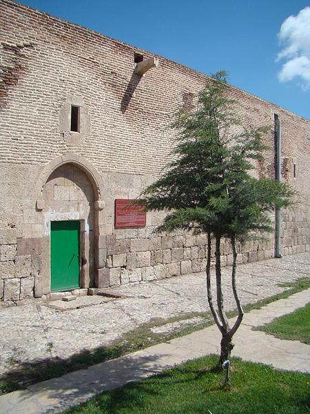
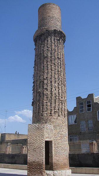
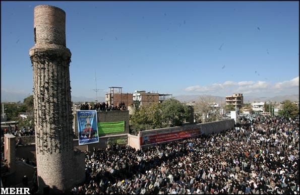
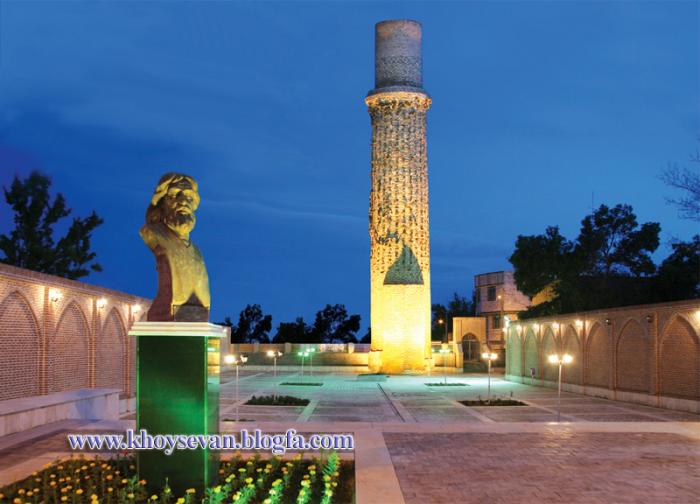
One of the important historic elements of the city is the St. Sourp Sarkis church. Armenian documents wrote that the date of the making has to be either 332 or 333 AD. In the city and it's surrounding villages, churches are seen and it's reported that Armenians have always been comprising a significant amount of the cities population. By the first half of the 11th century the Byzantine emperors were actively trying to round off their eastern territories, in an attempt to absorb the unstable Armenian dynasties. In 1021-2 emperor Basil II led his army as far as Khoy within 175 km of Dvin, and obtained the surrender of royalty from the Artsruni dynasty of Van.
Khoy was fortified at various times in its history, most recently by the Qajar dynasty in the Nineteenth Century.
After the death of Nadir Shah Afshar in 1747, Khoy broke away from central government of Iran like several other regions of Iran, including what is now Georgia and some of the northern Caucasian Khanates comprising the northwestern territories of Iran. Khoy became the centre of the newly established Khanate of Khoy (1747–1813) which was loyal to the central government only when it was powerful (like during Karim Khan's reign), and autonomous when the central role was weak. The return of Khoy to the central government of Iran was during the beginning of Qajar period during Agha Mohammad Khan's reign. Khoy was attacked by Russia in 1827 who was attempting to seize the last of the Caucasian territories of Iran comprising Armenia and what is now Azerbaijan during the Russo-Persian War (1826-1828). The war, which mainly razed in the extremely nearby South Caucasus region eventually happened to moved deeper south as well. Until 1828, Khoy had a large number of Armenians, however, the Treaty of Turkmenchay following the outcome of the 1826-1828 war and the victory over the neighbouring Ottoman Empire as concluded in the Treaty of Adrianople, encouraged the mass resettlement of Armenians from both Turkey and Iran in Russia. In the mid-1800s some of them immigrated to eastern Armenia, which by then had just became part of the Russian Empire. However, a small Armenian population remains living in Khoy. Eli Smith notes in his "Missionary Researches in Armenia: Including a Journey through Asia Minor, an into Georgia and Persia" released in 1834 that he and his group had heard whirl passing through Khoy that the city had between 4000 and 7000 Muslim families, while only about 100 Armenian families were left. He noted further that in the villages around Khoy there were a few more, but the vast majority had migrated to the North of the Aras river following Russia's victory over Persia in 1828 and the encouraged settling in the newly incorporated Russian regions of Eastern Armenia.
In 1911 Khoy was occupied by Ottoman troops, followed in World War I by Russian troops, who withdrew in 1917. In World War II it was again occupied by Soviet troops, who remained until 1946.
Khoy (Persian: خوی, Armenian: Հեր, romanized: Her or Խոյ, Azerbaijani: Xoy/خوی, also spelt Khoi or Khvoy, is a city in West Azarbaijan Province, Iran. It is located north of Urmia. The region's economy is based around agriculture, particularly the production of fruit, grain and timber. As of 2012, the city had a population of approximately 200,985. Today the city's population is mostly Azeri, there are also Kurdish, Assyrian and Armenian minorities. The main religion is Shia Islam there is also a Christian minorities. Occupied since Median times, it shares a long history as an important Christian centre.
Spoken languages.
Today Azerbaijani is spoken in Khoy, while nearly all inhabitants...
 Reduce description


Recent city comments: